Monday, July 29, 2013

Seorak-san


Jina could see that this summer break, while giving me awesome days at home with J-bear and plenty of time for my own pursuits, needed an additional injection of travel and change of venue. So she graciously (I love you, yobo) booked me a hotel for three nights in Seorak Valley. I kissed Jonah goodbye leaving him in the ever-able hands of Halmoni, fueled up the car, and came to Seoraksan armed with some running gear, a guitar, and a few good books.
Isn't it cool to know that there are places that stamp indelible impressions deep down, places that we feel an invisible pull back to time and time again? In Korea there is Seoraksan National Park. It’s a mere two hour drive from my house, yet the three or four times I get out here each year is not enough. Each and every time I come, I have a deeply personal response. Seorak has a palliative effect, certainly—once here it is easy to leave behind work or the myriad stresses that creep into our daily ventures. But it is also restorative, sending me back home reset, regenerated, and with a dose of zest that I didn't bring with me. God seems to have strategically placed these locations within reach, to periodically lift up the soul, to remember who we are, and to connect with creation with a thankful and joyous heart.

Day 1:
It was raining when I arrived, but I decided to get out anyways and do a “warm-up” run up to Ulsan-Bawi. I ran through a downpour, skipping and hopping over the rocky path, up the valley that gradually brought me to the base of this incredible collection of rock. Ulsan-bawi juts up out of the trees, a giant granite wall standing vigilant at its watch of the eastern sea. Most of the ascent is now decked out in stairs, taking a bit away from the fun and slightly sketchy scrambling that was required in past years. Gone are the old dodgy stairs and the rope sections that gave it a fatal appeal, but it has had absolutely no impact on the views from up top. This view stands up with any natural wonders that I've ever ogled. On this occasion, the white clouds pushing off the East Sea were rushing headlong into the rockwall, and pushing upwards, and rolling back on themselves like waves in the ocean.

I headed down, grabbed a shower at my room, then headed into town to pick up some famous Mansoek- Dalkkongjang. I grabbed a beer, and went up to the room and was, indeed, the luckiest man.

만석닭건장 This is Korean style Saucy chicken at its best, from the outdoor market in Seokcho. 

Day 2: Set the alarm for 4:30, but woke up just before. I jumped right into my gear, made coffee, had some cream bread ala Paris Baguette, and stepped out into the drizzling morning. On previous trips, I had learned that in order to miss foot traffic on the trails up Seoraksan, an early morning start was required. But not today-- there were no more than five cars in the parking lot as I pulled in. I ran the first 4km in the park, through the deep, wide valley surrounded by the all-seeing peaks of Seorak. The path follows a wide, rocky stream, tumultuous with the summer rains and making a percussive melody. My plan was, as in the past, to do a direct ascent up to Daecheong-bong, the highest peak at 1,701 meters, but as I crossed a bridge past the final little store before the climbing truly began, I saw that the gate for my route was closed and locked until the rangers showed up. Rather than climbing the fence, or waiting, I took this as a sign from Providence to hit a different route, one that would add 4km but take me past two Buddhist hermitages where I could fill up on yaksu, the Korean spring water found at most temples. The first section I had done years earlier, climbing this steep rock wall face on a path carefully sculpted out by the monks who traveled the path for centuries. There were moments of torrential downpour, but it lasted no longer than twenty minutes and then settled back into a lazy drizzle. I climbed, and climbed some more, finally reaching a pass that granted access through a causeway of rock shaped by a constant and mighty wind from the coast. Having crossed through this wind tunnel with my hand on my hat, I began descending again, back down through a forest following a crystal clear stream, which, running out of water, I took a risk and drank from. I came across the first hermitage (Seaoh-am), took a breather, filled up my water from the yaksu, and continued on, climbing again steadily as I crossed several ridges. The path was always next to water and the forest was lush with black soil, brilliant greens sprouting everywhere. The birds and chipmunks were playing all around me and I began to feel a bit like a trail running Francis, seeing the glowing divinity of God in the spectacle of the natural world.


Saeoh-ahm, and the yaksu station.


Beongjang-ahm nestled high in the Seorak mountains.


Even when the steep climbing began, I floated up in high spirits, and before I knew it, I crested another pass, this one even windier than the first. As I rolled through the corridor of the pass I could see the Bongjang-ahm, the second Buddhist hermitage, this one bigger and more established than the first. I quickly snapped some photos, took in the immense panorama of the landscape free-falling from the high elevation all around me, and continued my final push, which was supposed to be two kilometers to Dae Cheong-Bong, the highest peak in the Seorak mountains at 1701 meters. Here is what it was like on top:


Insane! I’ve never been anywhere with wind pushing that hard, where I literally had to brace myself on several occasions from toppling over, flying off the side of the mountain. I didn’t hang out too long.
The perfunctory summit photo. 

The descent, in the beginning, was tough. Super steep, and the path made by large rocks made it a gingerly affair of stepping down on tired, near-buckling legs. I had run out of food, and was praying that a shelter, that I rememberd from years past, might just have some food. The other shelters were closed and no one around to sell food. I was getting dangerously hungry, especially considering that a wrong step down the step rock could really do some damage, so when the path turned to staircases, and I could see the top of a building below, I got hopeful. And yes, there was one guy working at the shelter, and he sold me what I will have to consider one of the most satisfying meals of the entire trip:

The best meal ever? nah... but you couldn't have told me that then.

As I was eating these little critters kept me company.


I still had a good seven or eight kilometers to go, but most of the technical descending was done, the grade mellowed out, providing a nice downhill run through a gorge cut out by this creek, that was abounding with waterfalls and little swimming holes, a couple of which I went in, remembering to never forego what the trail offers. And by this time, the morning rain clouds had burned off and it was blazing hot.


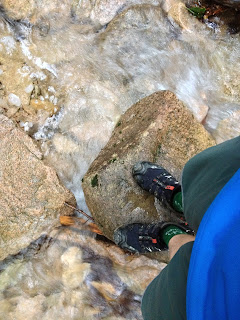
Lots of water on the trail, and some great swimming holes!


But I made it back to the car in high spirits, 25.5km round trip, and over 2500meters of climbing. Oh, and it took me over eight hours!
I hit the beach for a little bit that evening, and settled back in the hotel room early for a good night’s rest.
I had put some things out on the balcony to dry, and had secured the lighter clothing with weights, but I ended up losing one sock and one insole for my shoe. No biggie. I had extra insoles waiting for me at home.
Day 3: Having no real plan, I slept in. But halfway in the morning, I had one of those sleep realizations that out of all my gear that was on the balcony, I don’t remember bringing in my hydration bladder. I quickly jumped up, looked around the room and the balcony, but it had flown (reminding of a brand new tent I had bought in New Zealand that had taken a similar flight off my Seoul apartment rooftop several years previous). I made a cup of coffee and went outside and had a good search around the hotel grounds, but to no avail. Alas! Now to find a replacement.
I had a couple of long cups of coffee, did a lot of reading, and got into gear around noon. I headed for the beach, swam some laps in the ocean, and then jumped in the car to head south to Gangneung to check out the Salomon store where I was told sold hydration bladders (they were 69,000 won, costing more than my Nathan bag, so I didn’t buy it), and to go visit So-Zacs, a little café run by a Mi-kookin named Zac and his wife So Jin. Zac is a climber turned trail runner and is putting on a fat-ass trail/road event in late September, so I stopped in and chatted with them, super nice folks, and I had me one of these:
Anderson Valley IPA at So-Zacs in Gangneung. 
 I decided that while I was down there, I would run some of the coarse that he had in mind for the race, so he drove me out to the trail head, and gave me the best instructions he could, and let me loose. Five or ten minutes later, I was lost. The trail was very faint and grown over in many areas, and there were several unsigned forks, and I quickly lost confidence in where I was. I decided to just follow one path out while my shins became bloodied by the thorny underbrush. I finally found a farm road, ran down that for a while, asked an elderly couple what the best way to get back to Gangneung was on foot, and after they insisted I take a bus and me telling them I was running, they finally, with some skepticism, pointed me in the right direction. I ran, made into a section of town, gave Zac a call, and he guided me back to the café. So, it ended up being a 15km road run, but I think I now pretty much know the general layout of Gangneung. As Thoreau said, "Not til we are lost, in other words, not til we have lost the world, do we begin to fin ourselves, and realize where we are and the infinite extent of our relations."Sometimes we have to go somewhere alone, get lost, meet new people, to remember who we are. I hopped in the car, grabbed an E-Mart pizza, cranked some of this, and drove back to Seokcho, where I slept like a rock.


Final day on the beach!

Day 4: Last day of vacation. Slept in, had a couple cups of coffee, read and wrote, packed up, and went to the beach to do this. And reflect. Seorak had once again, like a long lost friend, crept in and brightened me up. What an amazing place. If you can, go there during the week, when there are less people out. I drove back refreshed, complete with energy reserves for a return into the wonderful world of the everyday, replete with diapers and baby formula, wonderful J-bear and my unsurpassable wife. 

Monday, July 22, 2013

Gangchon 50km Out and Back


"I am running 50k."
"You're what?"
"Shhh, keep it down! I said I'm running 50km. Gangchon course out and back."
"Why are you doing that? You know from experience how much it hurts, and you've not been training properly."
"Hey, I've got a pretty decent base and I've been doing 60 to 80km every week for the last two months. And besides, I've been listening to a ton of Talk Ultra podcasts and Ultrarunner Podcast.com lately, so I know what I'm doing!"
"But that's gonna hurt."
"Listen, I'll be fine. I've gotta plan. I'm going to keep it real quiet, take it super easy on the climbs, and enjoy a nice leisurely day out on the mountain. My legs never need to know the full extent of what I'm embarking on."
"You're a bit daft, aren't you?"
And the plan ensued, meeting Yann at Gulbong station for a quick chat, before we could no longer delay what lie ahead. 50km, over 3,000 meters of climbing, and right in the middle of a summer day that could, if feeling particularly unfettered, pummel us with a simultaneous heat/ humidity blast.
I stayed on plan, never kicking too hard in the kilometers leading up to the first climb. I kept a steady but sensible pace up the first section, while watching Yann tearing away around the first corner, and I even power-hiked the steeper sections of the first climb. The weather was wonderful, maintaining in the low 20's, a nice veil of clouds protecting us from the fiery disc above. I kept my cool on the long descent, never dipping below a 5:30 pace, and felt great as I rounded the corner at kilometer 12 to begin the second ascent. Gnawing down a Clif Bar, I once again walked the steep sections and breathed easy as I met with Yann at the top of the climb. That would be the pattern, the speed rabbit would fly, I would trounce along at a respectable pace, fooling my legs into thinking we were just out on a leisurely stroll.
The descent down into the village showed the carnage that was wreaked in Gangwondo the previous week, a la jangma, the rampant Korean monsoons that nearly took out Andy and I on our Indiana Jones-esque run the Sunday before. The road was washed up, over, and out. In some sections, the creek had diverted onto the road, and showed no sign of re-joining its former path down the mountain. Looks like some work for the engineers if they ever want to have their annual mountain bike race here.

  So, that made for a slow descent, but as slow and easy was the MO of the day, I was not complaining, only marveling in the perverse way that the human mind marvels at scenes of great destruction. Got down into the village, took a dip in the river crossing, and made our way up the "final" climb, where I once again walked sections, whistling, enjoying the scenery, and being ever-mindful of the blessing of mild and dry weather we had. Pulled into the turn around at just under three hours, a very respectable time for such a leisurely day in mother nature. Yann, ever-patient, ever-waiting, said nothing, just waited at the tops of the climbs before setting off on his blistering pace (can't wait to see the times that this guy throws down in races over the next few months!).
Tossing back a Coke and a tin of Pringles for that much needed sodium re-uptake, we filled our hydration vests and quickly set off in the opposite direction. No problem, I told myself. I was on fresh legs, and just beginning the run of a normal day at Gangchon. My plan of simply not acknowledging what I was doing was working like a charm. I thought I might even take some time off the laps on the return trip, and have one of those curious instances of finishing stronger than I had started. Hardy had-har.
I began the ascent nicely enough, took in the always encouraging expressions from the hikers (ah, jeongmal dea-dan-he! really amazing!... Why, thank you for noticing!) Another hiker threw out his thumb and said with force and conviction, "Nice guy!" Awww shucks. My legs seemed to still be under the impression that this was meant to be enjoyed. I even kicked up the pace a notch and felt pretty darn fantastic. At last I saw the summit and kicked a little harder, knowing that I had plenty of downhill ahead on which to recover. False summit. Really? You got fooled by that again? One more kilometer to go, and my legs, for the first time all day, began writing protest songs that they would sing into my darkening mind for the rest of the day. I tried to shrug it off, but an involuntary groan escaped me, an indicator, that I know all too well, that the struggle was about to commence. Not good-- this was the first climb of three with 20km left to cover.
I made it down the next descent well enough, but was slowed down by places where the road was washed out and covered with fallen trees, which made it difficult to maintain any rhythm. I finally made it down to the creek crossing, and perfunctorily I jumped in, remembering some sage wisdom I once heard for ultra distances: "Never pass by cold water and give yourself something to regret later." The cold water is invigorating, it shrinks the capillaries in the legs momentarily for a numbing effect, and it lowers core body temperature. Emerging refreshed, albeit a little soggy, Yann and I run through the farming village and make our way back up the second return climb. This time the earbuds go in, and the power hiking begins over the rough, washed out road.


As I got to towards the top, this track began to play and my legs followed, and I felt like I was flying up the hill, sweat flying off my face in this mad burst of energy, I could see the summit, and so I dug in, leaping up the climb like a spirited antelope, I could almost make the summit just as the last banjo note rolled over and.... what the heck? Another false summit! No!! I know this run too well to be fooled by these mendacious bends on the trail. Granted, it had been a while since I've run this direction, but I think my falling into the trap was born out of the state of suffering that my mind was beginning to enter into. But, not time for such thoughts, move forward. relentless forward progress, thanks Bryon Powell.
I carried myself up and over the climb, and then cursed my way down the short but steep 1km descent, rounded the corner, and set in for the final 6km climb and 6km descent to the finish.
I won't bore you with further details, but it involved many minutes with my hands on my knees, staring at the earth, praying. There was a phone call by my wife, who was waiting patiently at the finish, and I think I yelled at her, telling her I was dying. There was another creek submersion, but it took me five minutes to crawl out of the man built ravine and finish the final kilometer. But I did. And that's what it is all about in the end. Finishing.
I'm not sure I'll ever run a pretty ultra distance. I'd like to. I'd like to have that kind of run where everything goes your way, and the dark spots come and go and clear away in enough time to enjoy the final kilometers. I'd like to find that magical, hidden gear that many ultrarunners say appears somewhere late in the race, a sixth gear of your soul. I'd like all of that, one day. But for now, I know that I can finish, even amidst the suffering, and I guess there is something pretty in that, after all. And as for pretending that I'm not running far, I'm not sure this is the best strategy. Sure, it helps to keep out the negative thoughts early. But in another way, ultrarunning requires a certain level of engagement with your body, the environment, and how these intersect to make it the raw, emotional experience that it is. I'm still learning how to trust and persevere with joy, while going through the suffering.
Enjoying the afternoon with family-- a great reason to finish!


Friday, June 7, 2013

Chuncheon Chicken Loop full report

In three hours, I'm setting off for, literally, the hardest physical feat of my life until now. Robb Kerr, Katie Tibbetts, and I are heading into the mountains to circumnavigate the mountain trail systems that make a giant 80+km (50+ miles) loop around the city that is currently our home. This feat has been, as far as we know, accomplished only once, by another foreigner named Mark Jolin, who did it with what seemed like minimal preparation and very little fanfare (other than his GPS track found here).


While the distance will be the most I've ever done, that is not what I'm particularly worried about. It is more the elevation that has me a little anxious. We will be gaining a total of about 21,000 feet or 6500 meters of elevation gain, and that is in a mountain range where we never reach 1000 meters. This means a lot of up, down, up, down, up, down, and then some really big ups, and downs.
While Jolin, who clearly must be a badass, did not need to prepare, we have gone to great lengths to run sections of this, think about routes and directions, sort out areas of the trail where we might get confused, and basically try and minimize anything that will sap any additional energy from us on this journey.
Yesterday the three of us were up at 6AM driving around for 4 and half hours to do food and water drops, and even that was tiring! Meticulous thought went into these drops, and I tried to make it so, given a 24 hour time, I am consuming close to 300 calories an hour. Here is the list of things in each drop: I tried to imagine myself in the frame of mind I will be in as we make our drop bag pick-ups over the next 24 hours.


I've kind of adapted a strategy of not viewing it as a long mountain run, but more a food pickup mission  on foot. I have roughly fifty bucks worth of groceries that my wife would be disappointed in me if I didn't retrieve and consume!

Other factors:
Last Wednesday, about nine days ago, I was jumping over a highway median as we were out on a night run, and I tweaked my ankle. Didn't roll it, but just came down on it hard enough to hurt something. I thought I might be able to run it off, but couldn't. Ended up turning around, but still ran 6 or 7km's on it, got home and iced it, went to bed. The next morning it was swollen and hurt to walk on!  My heart sank as I realized that this would probably be the death of this run, but I have managed to heal pretty much fully. But, and this is a big but and I cannot lie, I have not run on it in nine days! My first run back on it will be this 80km! My plan is to evacuate if it starts acting up in the first 10km, but I am optimistic that it is strong enough.

I sliced my finger to the point of needing stitches while I was trying to make a drinking tube hole in the top of my backpack. I didn't go to the hospital, but cleaned the cut and super-glued it. I'm just hoping it does not bust open on the trail.

This morning I was doing some house duties and managed to inhale too much bleach, which made my eyes sting and gave me a dull headache all day, and I feel slightly short of breath (not a good sign when the first 3km of our run will have a 400 meter climb!

So, basically, I'm making this harder than it needs to be. Please pray for us!

Gear:
I've decided to leave the Nathan pack at home and go with my bigger 25 liter pack made by Bailo. The Nathan pack would, I fear, leave me a little too at mercy of our speed, and I really don't want to be pressured by conservation, especially on a really hot day as it will surely be tomorrow. The Bailo pack will let me carry extra water and extra food, and I've run in it plenty and know its comfortable.

Compression socks and shorts: never know if it works but if I think they are helping me, then they will be helping me. Placebo or real, I'll take it.

Shoes: Hoka One One Stenson Evo B. 3 pairs of socks: One Smart Wool, one pair of cycling socks from The Sock Guy, and starting off with some tri socks from Primal. I'm planning on using them all.

Headwear. Just a Salomon visor for the sunny sections, and a bandana for the rest of the time.

Clothing. Mountain Hardwear "Way to Cool" shirt, love this amazing wicking garment, and Patagonia Strider shorts, the shorts that you literally forget you are wearing.

knick-knacks: pocket knife, headlamp, 2 liter water bladder, extra water bottle, superglue, ibuprofen, bandaids and bandages, Koday Playsport video cam, Body Glide.

Man, do I have the butterflies. I was going to try and nap before but now I'm just getting amped. Think I'll just listen to this instead!
I'm just psyched to get to try this! Thank you God for making creation Good and giving us your mountains and forests to play in and enjoy. See you all on the flip!

Update:
We did not finish. Made it through a good portion of the night, everyone feeling good, my ankle proving it would be strong enough for the journey, and we set into a nice pace through the night. But everyone became aware of the intense humidity and the presence of a heavy, gritty pollen in the air, and it started to work pretty hard on our breathing, enough to render it impossible for Robb to continue. But Katie and I, with heavy hearts, decided to keep going.

At first I couldn't appreciate what I was feeling, a definite sadness that Robb was out-- but it dawned on me that it was deeper than that, something that was inextricably bound with our motivation, excitement, and joy for setting out on what was definitely going to be a punishing journey. The suffering would all make sense and even be redeemed in the light of the ties that we shared as a group, as friends. And as both Katie and I pushed up more climbs through the dark, this realization seemed to set in and take hold. If we are not all going to finish, then why are we doing it? This is a deadly thought at 2AM, but I don't think, even now, that it was inauthentic.
This journey was about friendship, it was never only about the run. This was definitely distinct from a race in this respect. In a race, the finish line beckons, talking you through the rough patches. In this case, it was three friends-- it was the spirit of interdependence-- which we would rely on. And when three became two, it was too much to recover from. The only word I could use to convey this to Katie was heartbreak. Not heartbreak from not finishing, but heartbreak that we were not all there together, getting ready for the next section, laughing and joking, and sharing our tiredness to make it less, to make it better.
In this respect, while I am disappointed, I do not regret our decision. If anything, I am only hungrier for the relationships that something as raw and intense as trail running rewards us with. I think this is my take away from this: to be thankful for such friends. Hmm, I think I just felt a tiny, almost imperceptible, itch for another long run with my crew!


Saturday, May 18, 2013

KimYuJeong to Soyang Dam


It is 4AM, you find yourself standing on the corner of a city street with a guy in spandex, a visor with a protrusion of blond fro exploding from it, and a headlamp. What the heck is going on? you ask yourself. Did I just come from a rave? Did I just break out of a mental hospital and this is my cohort? And then a sip of coffee brings you back: Oh, yeah, I'm going trail running with Robb!
Robb, looking ... tight!
Today, the plan was to do a 33km mountain run from Kim Yujeong Station just outside of Chuncheon and traverse the mountains and the main ridge on the Chuncheon circuit trail over to the bottom area of Soyang Dam. To date, I am pretty sure that this is the furthest we have been on any one section of this trail, and today was gonna be epic!
The reason for the early start was two fold: first, we would finish before noon and have the rest of the day for family and "major errands"; or, in my case, a long nap, and scarfing a plate of nachos while parading around in my apartment in compression gear (the stuff works!). The second reason was to beat the heat, and thus, require less hydration. These spring days are starting to warm up considerably and the signature mugginess of the Korean summer is starting to emerge. There is, as far as we know, no water or springs on this track without a significant detour and backtrack, so we both set off with the two liters in our Nathan packs and a handheld water bottle. This proved sufficient-- I finished my water right in the middle of the last climb, and nothing was left but a fast descent to the joys of the 편의점 (convenience store). Conserving water can be a bit tricky, especially when hydration is absolutely crucial to get tired legs up and down climbs safely, but the more time I spend out there the better I become at knowing what I can get by on.
We started slowly up the first section of the day, a climb up GeumByeong-san. To get there, we had to weave through winding farm roads, our headlamps bouncing reflections off the submerged rice paddies and the glowing eyes of growling 진돗개 (Korean breed of hunting dog and protectorate of farms). Robb had to deuce, so I continued up through this enchanted grove of trees alone, turned off the headlamp, and felt the forest come alive with birds and little critters stirring up the dawn. It's reassuring knowing that you get to trade a few hours of sleep for this! The trail, in typical Korean fashion, started to shoot straight up the mountain, and we were digging in and climbing. We reached a ridge soon enough, and started running the rollers, still climbing towards the top. The azaleas were everywhere, and Robb noted the strong smell of honey in the forest. We passed by a tent, nestled in a sweet little spot of the trail, and then a small tent village near the peak (금병산 630m). These folks had the right idea. The could sleep and enjoy the honey-smelling forest simultaneously. We snapped some quick photos and began our descent, and it wasn't even 6 o'clock!


Our next section takes us over our familiar 수리봉 (Soori Peak) and 대령산 (Daeryeong-san), and we climb up through the forest, rolling over lesser peaks that offer picturesque views of Chuncheon in the morning. We reach Daeryeong-san, and it is only 8 o'clock. It is one of the more popular peaks in Chuncheon, and there was no one there. We became very self-congratulatory at how bad ass we think we are, but moments later as we began our descent we passed an elderly couple, smiling as they climb a steeper section of the trail towards the peak. Yep. Gotta love Korea. We make our way down, get to Myeong-bong and hang a right to go to Neuratchae, where we hit some great rolling but runnable sections of trail. At about 23km in, I start to feel the telltale signs of a bonk coming on- dizziness, wobbly legs, a strong desire to stare at the moving patterns on the ground; so as soon as we hit the connecting fire road at the top of 느랏재 (Neuratchae), we scarfed down our peanut butter sandwiches and I threw down a Gu for good measure.
Add caption
Spring has come to the mountains!

Robb speeding along the quick single-track.

We get to our last section of trail, an 8.3 km section that should easily follow a ridge down to Soyang Dam, and we think we can make pretty good time if we can get some good running in. But about 2km into this, we get lost (you can see a long line jutting out on the Strava track), and of course the section where we get lost takes us down, and down, until we realize we have to turn around and climb back up to find the track again. Pretty demoralizing and energy-sapping. But it gave birth to a great maxim from Robb: "If the trail looks shite, it ain't right!" We got back on the trail and made our way through some beautiful, lush green sections of forest, much of it runnable but sprinkled with some leg-murdering steep climbs, quite a few which stopped me in my tracks, and with hands on my knees I again and again took to my intricate study of the forest floor. A study in dirt, if you will. Soon, again, we are heading down, down, and the trail starts to take on a more "shitely" veneer. I bring this to Robb's attention, and again we backtrack, up, of course, and find the trail, a little more deflated. Then we descend some really steep stuff through a particularly lush section with lots of ferns popping up out of black soil. That levels off, and then we see another peak in the distance, and as Robb told me we have to climb it, my heart started to sink. I have an pervasive tendency to go negative in the face of adversity, and the trail is a place where I can see this firsthand and actively work through it. I reminded myself of the absolute blessing that God gives of nature and health, and the gift that we have to play and enjoy it. And, to boot, I still had power in my legs, something I forget when I go into complaining mode. Robb always provides a positive model, as well, because the more suffering there is, the more he relishes it. So, I ate my final Clif Bar, sucked down my water, and actually started to move up the mountain, Robb being an uncatchable rabbit (jackrabbit) to chase, and before you know it, we are at the top peering down on the reservoir of Soyang Dam.

Soyang Dam, here we come!

This song came to mind and we started belting out the few lyrics we both knew.  We make the final descent, hit the pavement where we try and stretch out our legs with a pretty good pace, and find ourselves in "civilization". I joke to Robb about what the Saturday, Soyang Dam crowd must think of the likes of us. Having no idea what we had just been through, I'm sure we looked like we hadn't made very good life decisions, like we don't have it together very well, and we freaking stink! And perhaps they are right on all counts, but none of that matters as we clink our cans of Pilsner Urquells and grins spread wide across greasy, salty, sweat stained faces. Great run, dude!

Saturday, May 4, 2013

Chuncheon Dam to Samak-san: The Dragon's Back


Robb cresting one of the many knolls in the fog.


A good view of what's to come.


In 2011, Robb and I set off to backpack the Chuncheon circuit trail, about an 85km trot that covers every single mountain of note in the Chuncheon area. But a rough day two sent us home licking our wounds. The problem being that on this particular section of the Samak to Chuncheon Dam route, we had to traverse about 8km of a completely exposed spine. There is a section cut out about 20m across (you can see in the photos), and the brush and thorny bushes, heavily aided by the monsoons of mid-summer, had grown ferociously tall, razor sharp, and so thick that you could not see your feet, but knew they were there because they were attached to the ankles and calves that were getting cut to shreds by sharp thorns. We navigated about 5km of this, up and down, up and down, until the string of profanities that flew out of my mouth was longer than the trail itself. We ended up coming off the mountain, cried in our beers, Robb lost a cell phone, and the trip ended. We ended up completing the rest of the sections as day hikes.
Robb looking strong on the dragon's back.
This un-slain dragon of a of trail has haunted me ever since, but for whatever reason, I was never able to get back out there and finish it until yesterday. Looking at the numbers, the dragon doesn't look so formidable: 22km according to my conservative Garmin numbers, or 26 on Robb's friendly android GPS, and 1500 meters of vertical gain. But memories of suffering can project their own shadows, and in this case those shadows hold a bit of truth.
The day began with a beautiful early morning jog along a creek, through green ferns and oak trees with a smattering of waning cherry blossoms. One kilometer in, we veer away from the creek and start the climb, a straight shot up 500 meters, and we dug into a hiking pace. As we summited, we were totally hemmed in by fog, so no stellar views, but it lent a kind of cool, eerie tenor to the trail. Perhaps just as well, too; a clear view would reveal two giant twin peaks about 180 meters higher than where we stood that we needed to traverse. A short reprieve ensued before climbing the first of these twins, and as we summited I felt jubilant, still unaware that we would descend 180 meters only to climb it right back up again. In the first 7.5km, we'd already done half of our elevation gain for the day.
Just beginning the descent after 11 kilometers. 
At this point, I felt pretty good, having done a good portion of the day's work early on (ha! foolish optimism). We hit the open spine that previously had brought so much misery, and thankfully, this early in the season, there are no biting thorn bushes waiting to cut us up. So we started the up and down, up and down that gives this section the appearance of a dragon's back as all one can see in the distance are these green undulations. This section makes for some fantastic running, and the views all around are pretty epic, except we were mostly still in the fog. But on legs that had just climbed over 800 meters, these undulating mounds started to take their toll. By the time we reached the big descent at about 11km, my legs were feeling pretty trashed. But the sun began to burn away the fogs and clouds, and we could see the expanse of the valley and the rise of Samak-san in the distance-- truly stunning. After we dropped another 300 meters, we veered back into the forest, and started another fantastic running section of trail winding and rolling through a thick forest of birch trees and oaks. I was feeling pretty dreamy as an evil stump materialized out of the leaves and reached up to trip me, sending me in a horizontal catapult over the forest floor. Look ma, I'm flying! I got up after a couple of stunned moments, walked off a slightly tweaked ankle, and right as I got to running again I found myself at the bottom of another 100 meter climb. Perfect.
At about 18km in, we crossed a fire road, and then began the last climbs of the day, a total of 200 meters, no easy task after three and a half hours and 1300 meters of vertical gain. At the foot of the final climb, I sat down and vacantly chewed down the remainder of a Clif bar, trying to summon the will to make the final ascent. Tagging far behind Robb at this point, I finally made it to the top, absolutely gutted. Looking at the clock, though, we decided to try and clear 4:30 for the day, and so Robb set off at a fast downhill pace, nimbly dancing off a rocks and roots and quickly cutting his way down the tiny switchback descents through the observing eyes of the birch trees. We passed a mountain temple, a sure sign that we were close, and hit the rocky, fast-dropping canyon path that became more and more cluttered with hikers. Navigating the rocks, roots, and hikers became quite a chore at high speeds, and my vision started to take on a sort of psychedelic glare, so I slowed down, deciding to forego a broken ankle for the day. Robb burled on, flying down the path that wound through the rocks, over bridges and waterfalls, and dropping 200 meters in the final half kilometer.
I finished at 4:37, Robb some minutes before, and our total moving time of the day was 4:07. At the end of the day, as I sat and stretched out my tender hip flexors and sore quads, we decided that we hadn't quite slain the dragon, but rather placated her just enough to gain permission to scale her heights and cross her long, rippling back. Rather than the dejection with which she sent us packing two summers previous, she had rewarded our fortitude and sent us away with a profound respect. Definitely the hardest 22km run I've ever done!